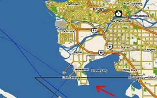
You probably remember from your grade school geography class that the 49th Parallel is the boundary between the U.S. and Canada between Vancouver Island and Minnesota. This produces the curious fact that -- if your are driving -- you have to go through Canada to reach Point Roberts, Washington.
Map above.
East of the Minnesota, a bunch of Canada is so far south of the 49th Parallel that 27 states are in whole or in part
north on the southernmost point of Canada (Middle Island, Ontario). Twelve states are
entirely north of Middle Island.
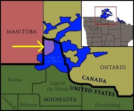
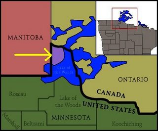
This brings us to the Northwest Angle of Minnesota -- usually just called the
Angle. Besides Point Roberts, it is the only other part of one of the contiguous 48 states that you have to drive through Canada to get to -- like Point Robert, you can go directly by boat.
Unlike Point Roberts, however, the
Angle sticks up
above the 49th Parallel, making it the northernmost point in the contiguous United States, and Angle Inlet the northernmost town in the contiguous 48. (Maine just looks as if it is the most north point because of map distortions.) It is a 40 mile drive to get from the rest of Minnesota to the
Angle -- this means crossing the international border between the U.S. and Canada twice.
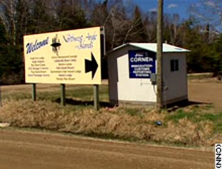
The customs check point between Canada and the United States, whether entering or leaving the
Angle, is on the
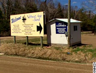
honor system. Yes, the honor system. The crossing is officially "Jim's Corner" and the custom house is the little shack in the photo below dwarfed by the sign. It has a video phone to connect to either U.S. or Canadian customs, but that apparently seldom works. If nothing else, the little shack is larger than some Amtrak stations.